The Camerons had organised for a collectivo (taxi) to take us to Moray. We had seen the turn off to Moray on the road up to Chinchero several days ago. Unfortunately, this was not the route taken by the driver. Instead
we travelled along a long windy dusty rough track with many switchbacks.
It was also very narrow and we encountered a truck coming in the
opposite direction at one stage. This was one road which nearly made the
TV show of Peru`s worst roads! Eventually we got to Moray.
Moray is an archaelogical
site where there are circles of Inca terracing which were used for
trialling different crops during Inca times. A greenhouse, disguised as a lookalike Greek amphitheatre. There is one well preserved albeit renovated circle and several others in original condition. We walked the circuit around the main site which was a warmup for the hike proper.


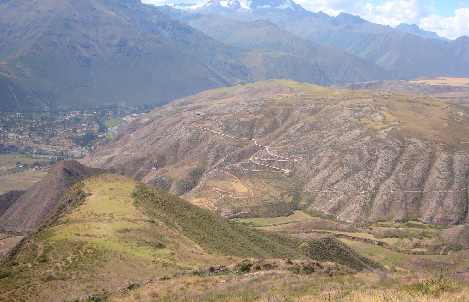 |
| The road to Moray |
We
set off on the hike at 1025, walking through fields and next to crops
with magnificent views of the mountains of the Sacred Valley. The track was undulating
to start with but after about an hour became quite a well made track, an old
road. This track followed the contour line of the mountain perfectly at a
constant altitude of approx 3500m. We stopped and lunched under the shade of a
eucalypt tree, the only one we saw all day.


After lunch we set off looking for a track in a downward direction, but could not find one.
The map that Simon had showed that the track should have started descending, leading us down into a valley, but instead we trekked on at the same altitude with
no other track in sight.


 |
| Trying to find a track down - attempt number 1 |
 |
| Where to now? |
We retraced our steps and continued on further. Then Simon and Jack
decided to leave us and go on looking for the valley track. After 30
mins and with the time approaching 3.15, they returned with bad news.
The path was damaged by rockfalls and the track was too dangerous for
us to negotiate.
We decided to backtrack back to the lunch spot. Simon then led
us down a gully to find a track down. The first attempt was without success, finding only sheer rock faces with 1000m drops. He then clambered down into another gully where he could see
a faint track.
At this stage we were all tired and frustrated and not entirely convinced that this plan was the right one. Some of us thought we should have continued back on the track we had started on back to a small village. The light was fading fast so we followed him down, very very slowly, the slope extremely steep and incredibly slippery with scree.
At this stage we were all tired and frustrated and not entirely convinced that this plan was the right one. Some of us thought we should have continued back on the track we had started on back to a small village. The light was fading fast so we followed him down, very very slowly, the slope extremely steep and incredibly slippery with scree.
Once Jen, Jack and I finally got down to this track, we set off , hoping to get down off this mountain before dark. We walked as fast as we could, trying to follow the track which we lost several times and
once the daylight had gone, we needed to use our mobile phones as torches.
Simon waited for Andrew and Barb who was really struggling with the terrain.
After about 30 mins on this track, we saw the lights of a house and decided to head towards that in
the hope that it would then have a road leading back to the main road.
This took some time in the dark as we tried to find a safe path down. As
we approached, more lights were turned on but no people appeared to see
who had set the dogs off barking. Eventually Jack led us around the
outbuildings and we saw the main road over the other side of the corn fields. We bolted
across the newly ploughed furrows and got to the road. Two women walking
along the road enquired in broken English about what we were doing and
where were we going. We pointed towards the mountain and as we looked
back, we saw another three lights slowly descending off the mountain. The
women called on a male friend and sent him off across the field.
Meanwhile, the others had managed to get down to the house where they were met by the owners and the male friend. After 20 mins, we were reunited. The ladies then escorted us to the main road and helped flag down a taxi for us to return to Ollanta. Not quite the way we planned to get back, but we were more than happy to get home!
Meanwhile, the others had managed to get down to the house where they were met by the owners and the male friend. After 20 mins, we were reunited. The ladies then escorted us to the main road and helped flag down a taxi for us to return to Ollanta. Not quite the way we planned to get back, but we were more than happy to get home!
The road back into the town centre was blocked off due to a local celebration, so we had to walk the last 2 kms back to our hotel. I can't say that it didn't end in tears, for some. The GPS said it was a 20km hike. I was bushed, and just so happy to have got home safely with no injuries.
Wow! What a day! And tomorrow - Machu Picchu!
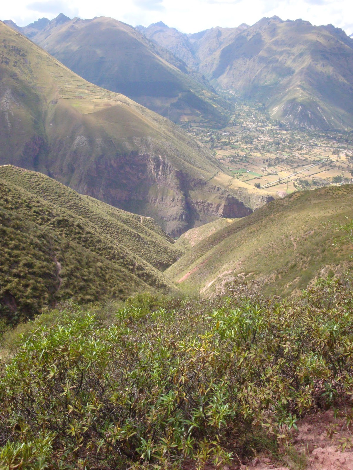
PS: These photos were taken on our way back to Cuzco from Ollanta 4 days later.
The first shows the rock faces of the mountain which prevented us descending on several occasions.
The second shows where we eventually finished the hike - now known infamously as "Black Saturday"


Wow! What a day! And tomorrow - Machu Picchu!
PS: These photos were taken on our way back to Cuzco from Ollanta 4 days later.
The first shows the rock faces of the mountain which prevented us descending on several occasions.
The second shows where we eventually finished the hike - now known infamously as "Black Saturday"


No comments:
Post a Comment